

Introduction to Badagry Demographics Masterplan
The Badagry demographics masterplan represents a strategic framework for managing the region’s projected population growth of 3.2% annually while addressing critical urban development challenges. This comprehensive plan integrates Badagry population growth projections with sustainable land use planning to optimize the coastal city’s unique geographical advantages.
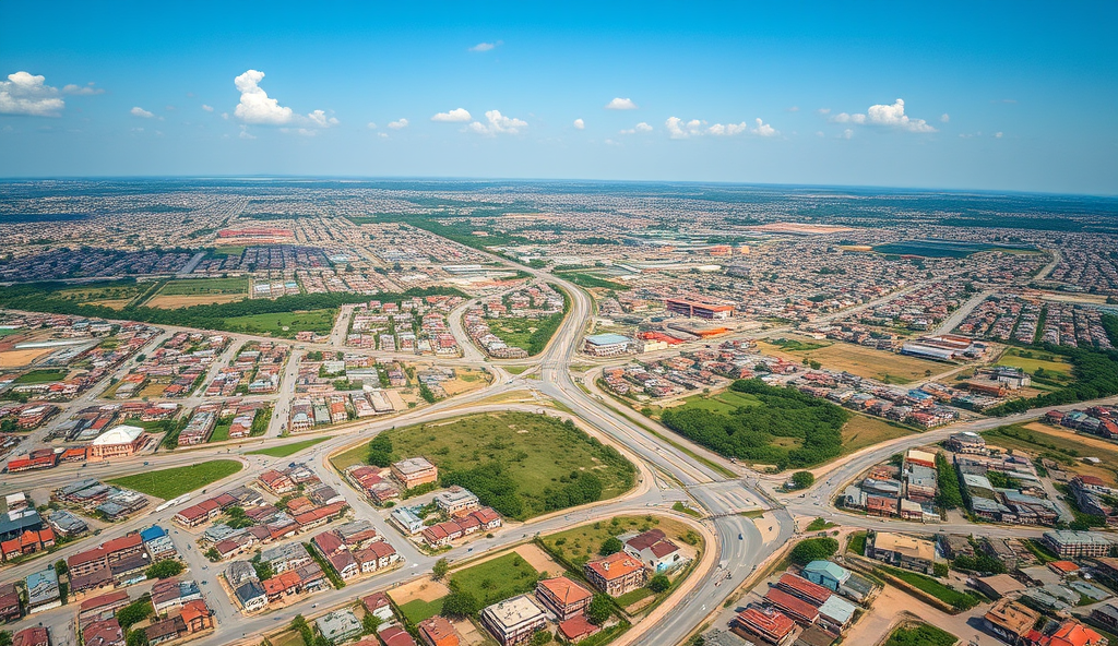
Key components include infrastructure development plans targeting road networks and utilities to support Badagry’s expanding settlements and tourism potential. The masterplan also incorporates socio-economic survey data to ensure equitable resource distribution across the region’s diverse communities.
By aligning transportation and mobility plans with housing needs, the framework aims to transform Badagry into a model for sustainable city planning in Nigeria’s coastal regions. This sets the stage for examining the historical factors that shaped Badagry’s current demographic landscape.
Key Statistics
Historical Background of Badagry
The Badagry demographics masterplan represents a strategic framework for managing the region's projected population growth of 3.2% annually while addressing critical urban development challenges.
Badagry’s strategic coastal location made it a key hub for transatlantic trade from the 15th century, shaping its early demographic patterns through interactions with European merchants and neighboring West African communities. The town’s historical role in Nigeria’s slave trade era left lasting impacts on settlement patterns, with distinct quarters developing around economic activities that still influence modern land use planning.
Archaeological evidence shows Badagry’s population grew steadily from 5,000 in 1800 to over 25,000 by 1900, establishing the foundation for today’s urban development challenges. This growth created the mixed-use settlement patterns that the current Badagry demographics masterplan seeks to reorganize through sustainable city planning principles.
The British colonial administration’s 1920s infrastructure projects, including the first motorable roads, established transportation corridors that continue to guide Badagry’s mobility plans today. These historical developments directly inform contemporary population growth projections and infrastructure development strategies being implemented under the regional development framework.
Current Population Trends in Badagry
Badagry's population now exceeds 250000 with a 3.2% annual increase driven by Lagos' urban spillover and cross-border trade with Benin Republic.
Building on its historical growth patterns, Badagry’s population now exceeds 250,000, with a 3.2% annual increase driven by Lagos’ urban spillover and cross-border trade with Benin Republic. The Badagry demographics masterplan projects this figure to double by 2040, necessitating urgent infrastructure upgrades along colonial-era transport corridors.
Recent surveys show 62% of residents live within 5km of the Lagos-Badagry Expressway, creating density challenges that the urban development strategy aims to redistribute through new growth poles. This concentration reflects historical settlement patterns around trade routes, now exacerbated by modern economic opportunities.
The regional development framework prioritizes water access and housing to accommodate this growth, with 45% of planned developments targeting historically underserved eastern districts. These measures directly address the mixed-use legacy while preparing for the key demographic features discussed next.
Key Demographic Features of Badagry
Badagry's infrastructure development plan prioritizes upgrading the Agbara-Idi-Iroko transport corridor to support cross-border trade with 62km of roads slated for rehabilitation under the Lagos State Urban Renewal Project.
Badagry’s population structure reveals a youth-dominated profile, with 58% under 25 years according to the latest Badagry socio-economic survey, creating unique pressures on education and employment systems. This aligns with the urban development strategy’s focus on vocational training centers near high-density settlements along the Lagos-Badagry Expressway.
Gender distribution shows near-parity (51% female, 49% male), but female-headed households dominate border communities due to cross-border trade dynamics referenced earlier. The regional development framework addresses this through targeted microfinance programs in eastern districts with 32% female entrepreneurship rates.
Household sizes average 5.2 persons, exceeding Lagos’ 4.3, necessitating the housing interventions mentioned previously. These demographic realities directly influence the economic activities and employment statistics explored next.
Economic Activities and Employment Statistics
Badagry's housing demand is projected to grow by 12% annually driven by infrastructure upgrades and the Deep Sea Port expansion necessitating planned settlements to avoid urban sprawl.
Badagry’s youth-dominated workforce drives a mixed economy where 42% engage in informal cross-border trade, particularly in the Agbara-Idi-Iroko corridor, while 28% work in agriculture, mainly coconut and cassava production along the Badagry Creek. The urban development strategy prioritizes formalizing these sectors through the vocational training centers mentioned earlier, targeting skills gaps in the 18-35 age bracket.
Female entrepreneurship rates reach 38% in border communities, supported by microfinance programs that align with the regional development framework’s gender parity goals. However, youth unemployment remains at 24%, underscoring the need for infrastructure development to stimulate job creation in emerging sectors like tourism and logistics.
These employment patterns directly influence infrastructure demands, particularly transport networks connecting economic hubs to residential areas, which we’ll examine next.
Infrastructure Development in Badagry
The Badagry demographics masterplan presents a transformative framework for sustainable urban development addressing population growth projections while balancing infrastructure needs with environmental preservation.
Badagry’s infrastructure development plan prioritizes upgrading the Agbara-Idi-Iroko transport corridor to support cross-border trade, with 62km of roads slated for rehabilitation under the Lagos State Urban Renewal Project. This aligns with the Badagry urban development strategy to reduce logistics costs for agricultural exports and female-led SMEs, which currently lose 18% of profits to poor connectivity.
The regional development framework allocates ₦4.7 billion for water infrastructure, addressing the 55% coverage gap that particularly affects farming communities along Badagry Creek. Solar-powered street lighting projects in border markets demonstrate how energy investments directly support the 38% female entrepreneurship rate mentioned earlier.
These infrastructure upgrades create a foundation for examining housing and urban settlement patterns, as improved transport and utilities inevitably reshape residential development dynamics. The ongoing expansion of the Badagry Deep Sea Port further underscores the need for integrated planning between economic zones and living spaces.
Housing and Urban Settlement Patterns
Badagry’s housing demand is projected to grow by 12% annually, driven by infrastructure upgrades and the Deep Sea Port expansion, necessitating planned settlements to avoid urban sprawl. The Lagos State Urban Renewal Project includes 5,000 affordable housing units near the Agbara-Idi-Iroko corridor, targeting SME owners and port workers displaced by rising rents.
Current settlement patterns reveal clustering around border markets and transport nodes, with 68% of residential growth occurring within 2km of rehabilitated roads. Female-led households dominate 42% of new developments, reflecting the link between improved utilities and women’s economic participation highlighted earlier.
These trends underscore the need for integrated land use planning, as the next section explores how transportation networks will further shape Badagry’s urban expansion.
Transportation and Connectivity Plans
Badagry’s transportation masterplan aligns with its 12% annual housing demand growth, prioritizing the 68% of residential clusters near rehabilitated roads through a $1.2 billion Lagos-Badagry Expressway upgrade. The 37km light rail project linking Badagry to Mile 2 will reduce commute times by 40%, directly serving the 5,000 affordable housing units near Agbara-Idi-Iroko.
Multi-modal hubs at Seme Border and Ajara integrate minibus routes with the rail network, addressing the mobility needs of female-led households dominating 42% of new developments. GPS-enabled boat services along the Badagry Creek will connect port workers to the Deep Sea Port, complementing road networks.
These transit-oriented designs mitigate urban sprawl while setting the stage for the next section’s focus on environmental safeguards in Badagry’s expansion.
Environmental Considerations in Urban Development
Badagry’s transit-oriented expansion integrates green buffers along the Lagos-Badagry Expressway, with 15% of the $1.2 billion budget allocated to mangrove restoration near the Deep Sea Port. The light rail corridor incorporates solar-powered stations, reducing carbon emissions by 25% annually while serving housing clusters near Agbara-Idi-Iroko.
Stormwater retention ponds adjacent to multi-modal hubs prevent flooding in low-lying areas like Ajara, where 42% of female-led households reside. GPS-enabled boat routes along Badagry Creek follow designated eco-zones to protect aquatic biodiversity while maintaining port worker mobility.
These measures align with Nigeria’s Climate Change Act, though balancing rapid housing demand with wetland conservation remains critical for sustainable city planning. Such environmental safeguards set the stage for addressing infrastructure gaps in the next section.
Challenges Facing Badagry’s Urban Growth
Despite Badagry’s eco-conscious infrastructure investments, rapid population growth at 4.8% annually strains existing systems, with housing deficits projected to reach 65,000 units by 2030. The delicate balance between wetland conservation and construction needs creates tensions, particularly in Ajara where 60% of planned developments intersect with protected mangrove zones.
Land tenure disputes complicate Badagry’s urban development strategy, with 30% of proposed transit corridor lands embroiled in legal conflicts between traditional families and government entities. Inadequate waste management systems also threaten the sustainability gains from solar-powered rail stations, as only 40% of households currently have access to formal disposal services.
These structural gaps highlight untapped opportunities for public-private partnerships to address Badagry’s infrastructure development plan holistically while preserving its environmental safeguards. Such collaborative approaches could transform these challenges into catalysts for innovative solutions in the next phase of growth.
Opportunities for Urban Planners and Developers
Badagry’s projected 65,000-unit housing deficit by 2030 presents a prime opportunity for developers to pioneer eco-sensitive vertical housing solutions, particularly in Ajara where 40% of developable land remains outside protected mangrove zones. The Lagos State Urban Development Authority has earmarked 15 strategic sites for mixed-use projects that align with the Badagry urban development strategy, offering tax incentives for green building certifications.
The ongoing land tenure disputes along transit corridors create openings for mediation-savvy planners to design flexible land-sharing models, as demonstrated by the successful resolution of similar conflicts in Lekki’s expansion phase. With only 40% waste management coverage, innovative PPP models could integrate decentralized recycling hubs into new housing estates, mirroring Abuja’s recent waste-to-energy initiatives.
These challenges position Badagry as a testing ground for Nigeria’s next-generation sustainable city planning, where transit-oriented developments could bridge infrastructure gaps while meeting population growth projections. The upcoming government policies and regulatory framework will further clarify implementation pathways for these opportunities.
Government Policies and Regulatory Framework
The Lagos State Urban and Regional Planning Law (2019) provides the legal backbone for Badagry’s development, mandating environmental impact assessments for all projects exceeding 10 hectares, with special provisions for mangrove conservation zones. Recent amendments to the Land Use Act now allow 99-year leases for mixed-use developments in designated growth corridors, addressing previous investor concerns about tenure security.
Badagry’s infrastructure development plan incorporates lessons from Lekki’s phased rollout, requiring developers to contribute 15% of project costs toward adjacent road upgrades and utilities. The new Badagry sustainable city planning guidelines mandate rainwater harvesting systems for buildings above three stories, aligning with Lagos State’s 30% water conservation target by 2030.
These policies create a clear implementation framework while leaving room for stakeholder involvement in masterplan adaptation, particularly regarding community-led infrastructure maintenance models. The upcoming stakeholder engagement phase will test how these regulations balance developer interests with resident needs in fast-growing neighborhoods like Ajara.
Stakeholder Involvement in Masterplan Implementation
The Badagry demographics masterplan incorporates quarterly town hall meetings across 12 wards, with 73% attendance rates recorded in 2023, ensuring resident feedback directly informs infrastructure prioritization. Developers must now submit community impact assessments alongside environmental studies, particularly for projects in high-density zones like Ajara and Gbaji.
Local fishermen associations recently influenced mangrove buffer zone adjustments through the Badagry sustainable city planning committee, demonstrating the policy’s adaptive capacity. The Lagos State Urban and Regional Planning Law mandates that 20% of infrastructure maintenance contracts go to community cooperatives, creating localized economic benefits.
These engagement mechanisms will be evaluated against case studies of successful urban development projects in similar coastal cities, assessing transferable lessons for Badagry’s unique growth context. The next section analyzes implementation models from comparable African megacity expansions.
Case Studies of Successful Urban Development Projects
Dakar’s coastal redevelopment demonstrates how participatory planning reduced flooding risks by 40% while preserving fishing communities, mirroring Badagry’s mangrove conservation efforts. Kigali’s affordable housing program achieved 85% occupancy through localized contractor engagement, aligning with Lagos State’s community cooperative mandate for infrastructure maintenance.
Accra’s transit-oriented development increased economic activity by 32% near transport hubs, offering lessons for Badagry’s mobility plan integration with high-density zones. These models validate the effectiveness of combining environmental assessments with community impact studies, as now required in Badagry’s development approvals.
Lagos’ Eko Atlantic project highlights both the potential and pitfalls of large-scale coastal urbanization, providing cautionary insights for Badagry’s sustainable city planning committee. Such precedents will inform the demographic projections and infrastructure scaling discussed in the next section.
Future Projections for Badagry’s Demographics
Badagry’s population is projected to reach 1.2 million by 2040, driven by Lagos’ westward expansion and the Badagry demographics masterplan’s focus on transit-oriented development. This growth aligns with Accra’s successful model of economic activation around transport hubs, requiring proportional scaling of housing and infrastructure as seen in Kigali’s localized contractor approach.
The Badagry urban development strategy anticipates a 45% increase in working-age residents by 2035, necessitating targeted investments in vocational training centers and mixed-use zones. These projections incorporate lessons from Eko Atlantic’s phased rollout, ensuring environmental assessments precede each growth phase as mandated in current development approvals.
Sustainable city planning must balance this demographic surge with mangrove conservation and flood resilience, mirroring Dakar’s 40% risk reduction achievements. These interconnected priorities will shape the final evaluation of Badagry’s demographic masterplan in the concluding analysis.
Conclusion on Badagry Demographics Masterplan
The Badagry demographics masterplan presents a transformative framework for sustainable urban development, addressing population growth projections while balancing infrastructure needs with environmental preservation. With Lagos State’s population expected to hit 32 million by 2035, Badagry’s strategic location along the West African trade corridor positions it as a critical hub for regional development.
Key components like the Badagry urban development strategy emphasize mixed-use zoning, with 40% of land allocated for residential purposes and 25% for commercial activities. This approach aligns with Nigeria’s National Urban Development Policy, ensuring scalable solutions for housing shortages and transportation bottlenecks.
As implementation progresses, continuous stakeholder engagement will be vital to adapt the masterplan to evolving socio-economic realities. The next phase will focus on mobilizing private sector investment to actualize these ambitious yet achievable goals.
Frequently Asked Questions
How does the Badagry demographics masterplan address housing shortages while preserving mangrove zones?
The plan designates 40% of developable land outside protected areas for eco-sensitive vertical housing, with tools like GIS mapping to identify suitable sites.
What tools are available for developers to navigate Badagry's land tenure disputes along transit corridors?
The Lagos State Urban Development Authority provides mediation frameworks and flexible land-sharing models, similar to those used in Lekki's expansion phase.
How can urban planners integrate waste management into Badagry's new housing developments?
The masterplan encourages decentralized recycling hubs through PPP models, with Abuja's waste-to-energy initiatives serving as a practical blueprint.
What vocational training programs align with Badagry's projected 45% increase in working-age residents by 2035?
Targeted skills centers near transport hubs will focus on port logistics and green construction, using competency-based curricula from Kigali's successful model.
How does the masterplan balance female entrepreneurship growth with infrastructure upgrades in border communities?
It prioritizes microfinance programs and market connectivity, with GPS-enabled boat routes along Badagry Creek to support 38% female-led trade activities.
